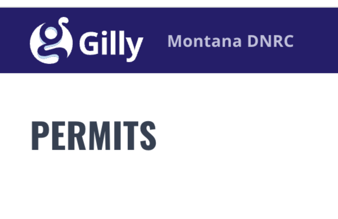
What’s New
This page summarizes recent updates to Gilly, including new features and improvements that make permitting, review, and reporting easier for everyone involved.
Version v21.0 6.2026
Autosave
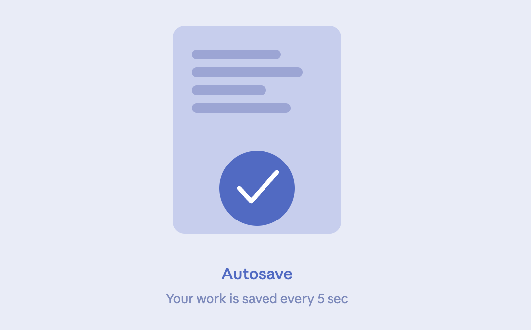
Your work is now automatically saved every 5 seconds across all forms. No more worrying about losing progress if something unexpected happens — Gilly has you covered.
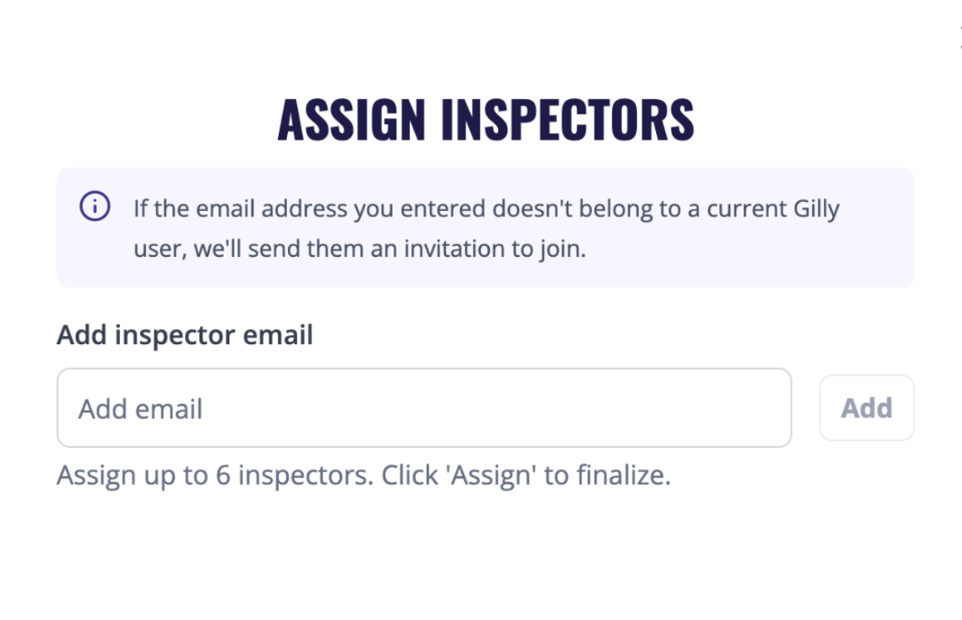
Inspector Assignment
Assigning an inspector is now faster and more accurate. You can search by email address and instantly find any inspector who already has a Gilly account, reducing the chance of errors when delegating work.
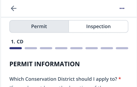
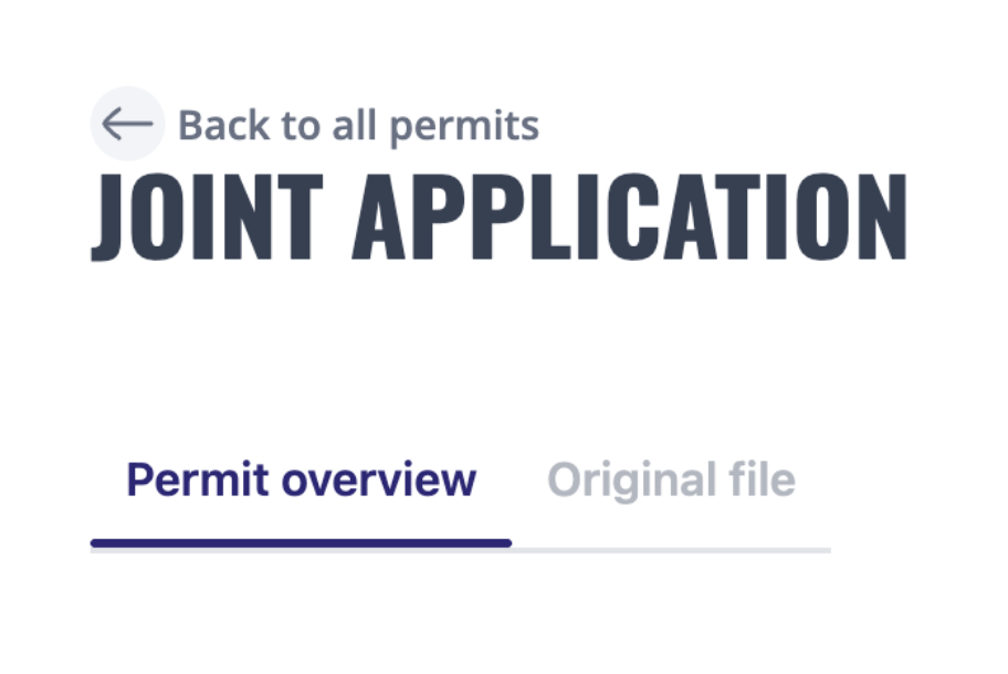
Streamlined Inspection Form
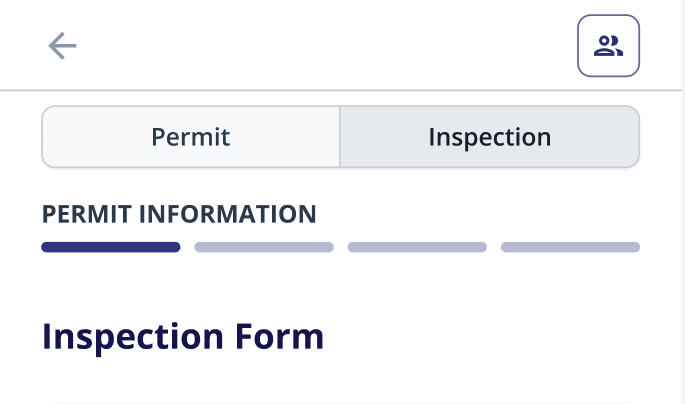
The inspection form is now divided into clear, sequential steps. This makes it easier to follow the process, know where you are, and complete inspections without missing anything.
Full Permit Access For Inspectors
Inspectors can now access everything they need directly from their own account — the electronic permit, all attachments, and the original PDF. Less back-and-forth with admins, and everything in one place when it matters most. [only available online]
Release Notes Version 21.0- 6.2026
Version v18.5.0 4.2026
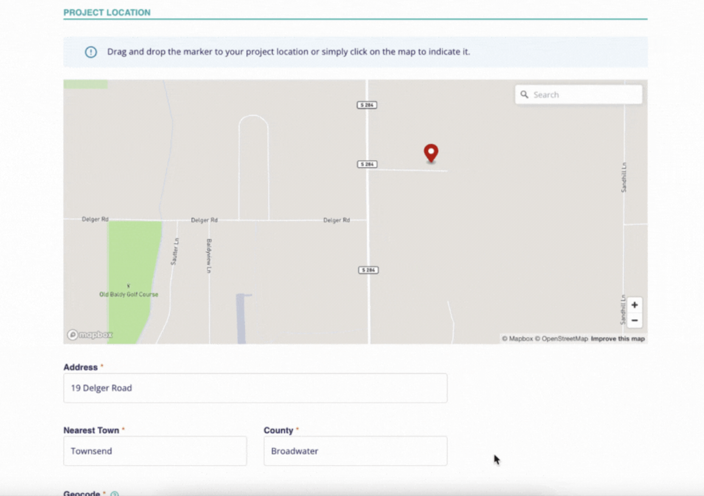
Permit importing improvements
We've added two new features to the permit importing flows:
Map: You can now pinpoint where the project took place directly on an interactive map.
Original file tab: The original source PDF now appears on a new tab to make it easier to validate the extracted data.
Platform Migration

We've migrated most of the platform to a new environment with significant performance improvements. You'll notice a slight change in look and feel — this is a significant milestone for us, and ensures the system is operating on the most up-to-date technology. We continue working every day to make Gilly better!
Release Notes Version 18.5 - 4.2026
Version 12.5.0: 12.22.2025
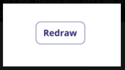
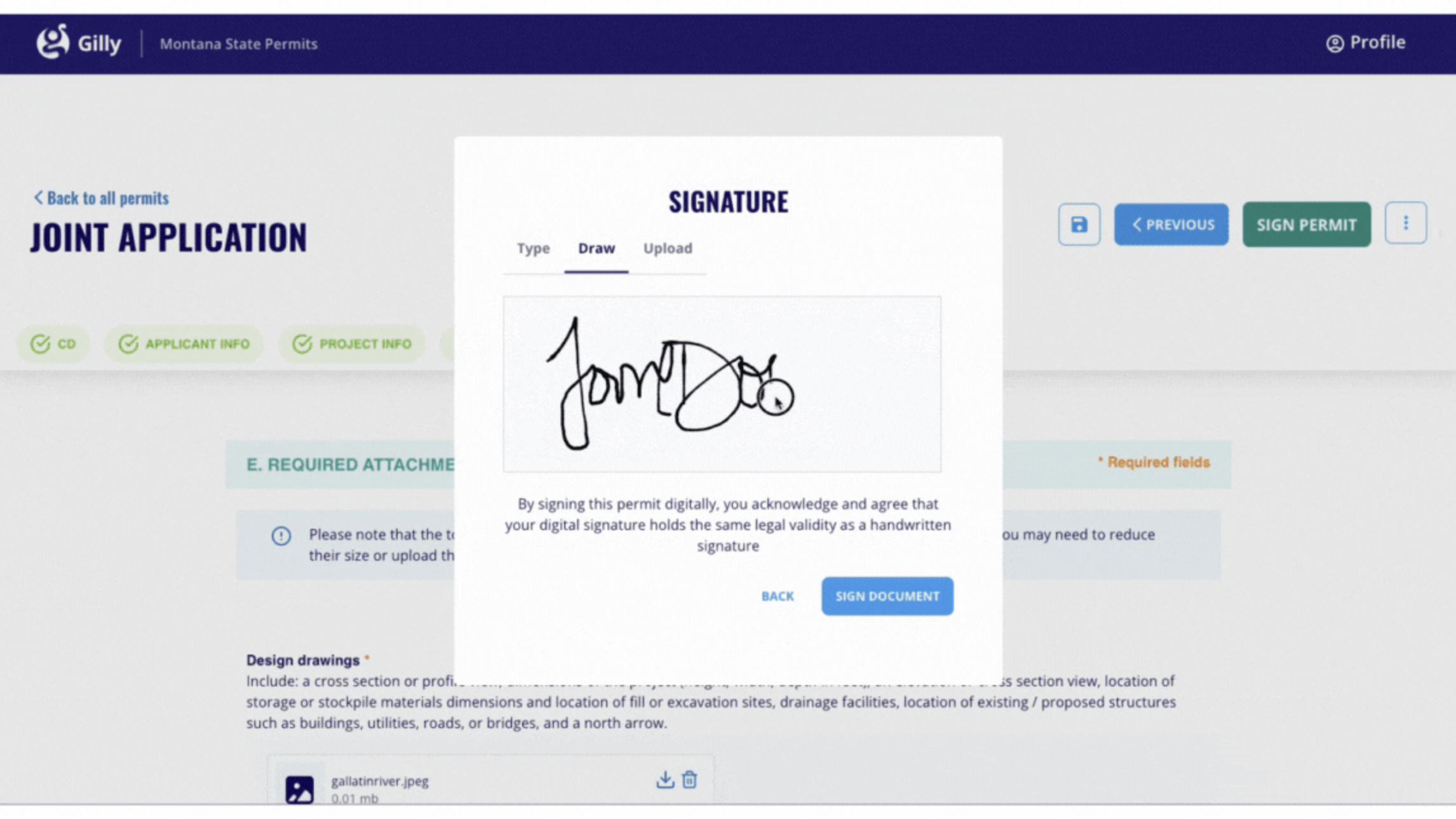
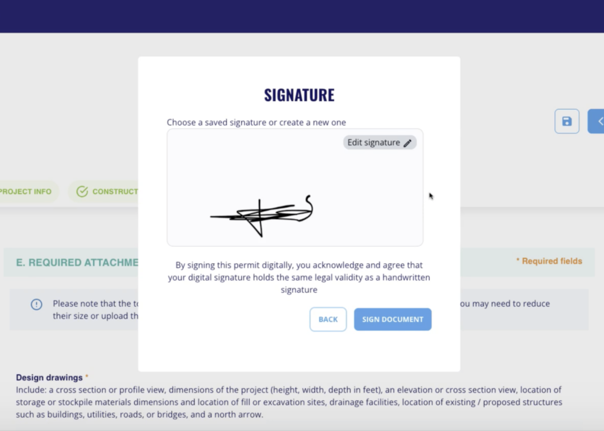
Easier Signatures on Devices
Signing forms is now simpler and more intuitive. We improved the signature experience by adding a “Redraw” option so you can easily start over, and optimized signing on mobile devices in landscape mode, giving you more space and better control when signing on phones or tablets
Release Notes Version 12.5 - 12.22.2025
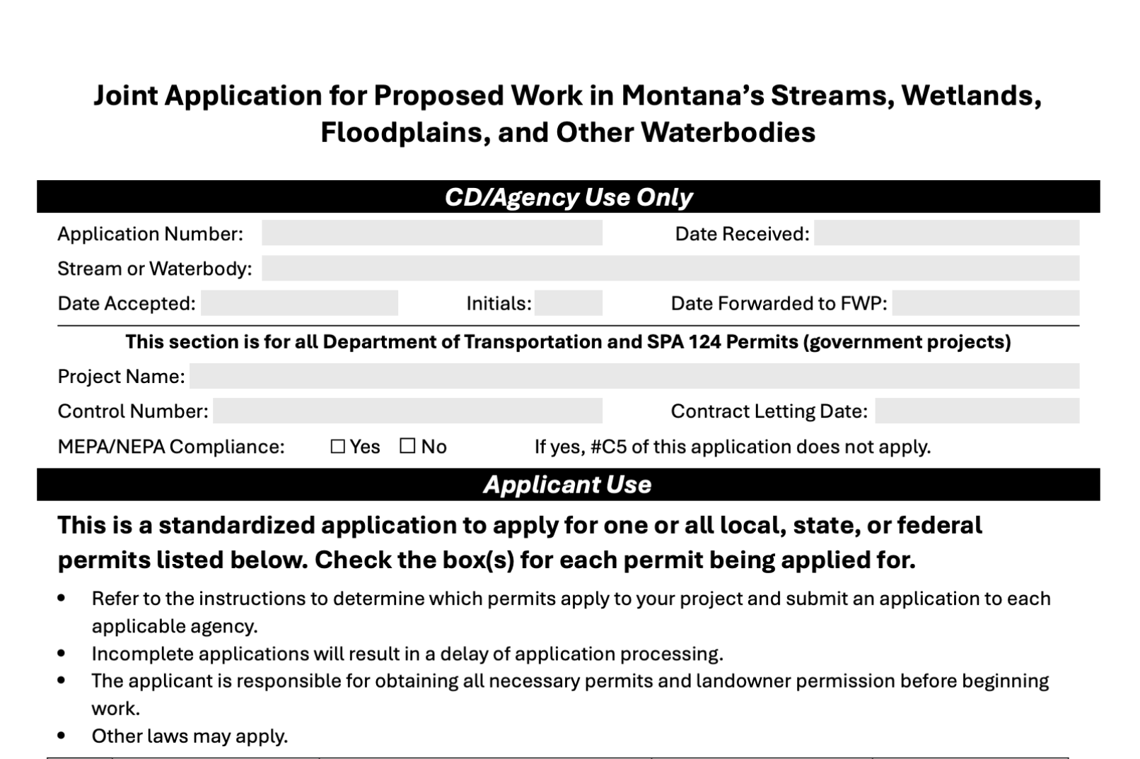
Cleaner Historical Permits Import
We improved how historical permits are processed and displayed to make the information clearer, more accurate, and easier to review.
Permit data is now better structured and cleaned automatically, including locations (latitude and longitude), email addresses, phone numbers, and addresses. Phone numbers are properly separated into cell and home, and addresses are split into clearer fields where applicable.
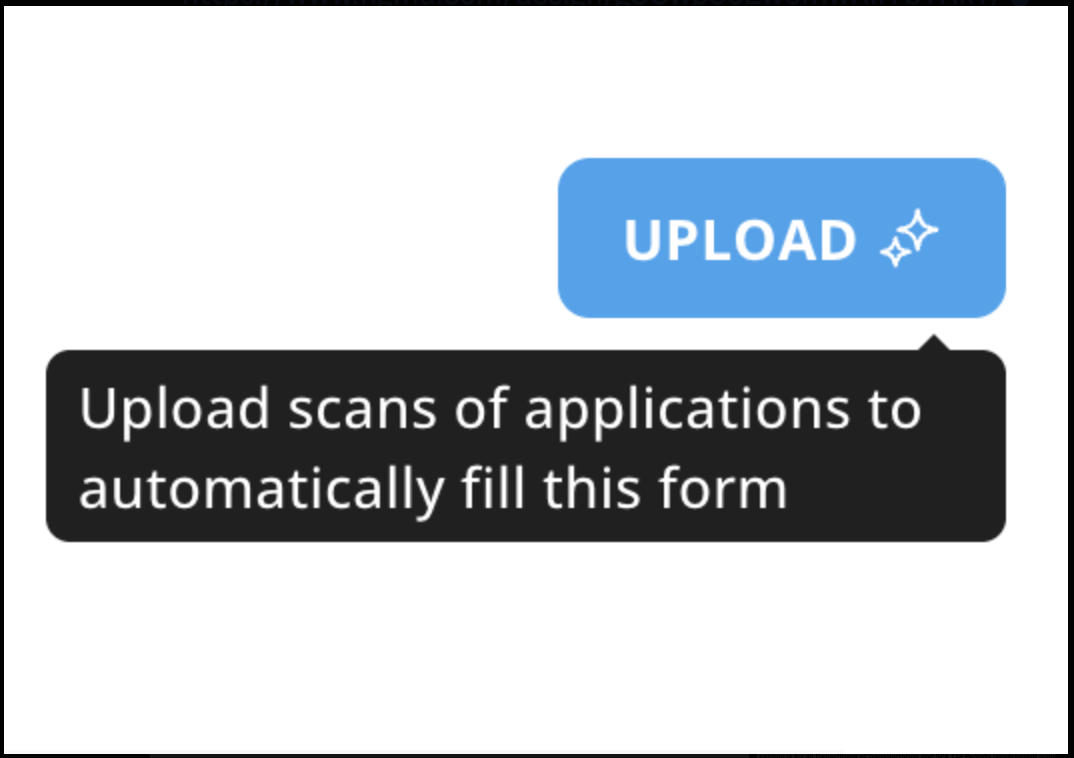
Upload scans of applications to automatically fill this form
Cleaner Application Forms PDFs
Application PDFs are now generated with better spacing and alignment, making forms easier to read, print, and complete by hand—especially in official sections like CD / Agency use.
Version 12.1 11.10.2025
Enhanced Map & Permit Viewer Experience
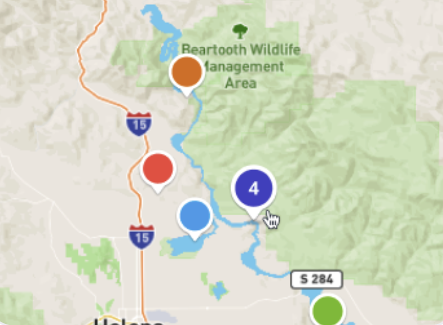
We’ve made several updates to make the map easier to use and more informative.
Grouped pins: Permits in the same location are now grouped together for better visibility on the map.
Smoother interaction: Click and navigate through permit cards more easily.
Media gallery: View project files directly within the permit details panel.
One-click PDF download: Download the permit PDF with a single click.
Instant filters: Filters now apply immediately — no need to click an “Apply” button.
Clearer controls: “Clear filters” and “Close” buttons are easier to find and use.
Expanded stream filter: The stream filter now shows all Montana streams, including “Unknown” and custom stream names.
Release Notes Version 12.1 - 11.10.2025
Version 10.0.0 10.29.2025
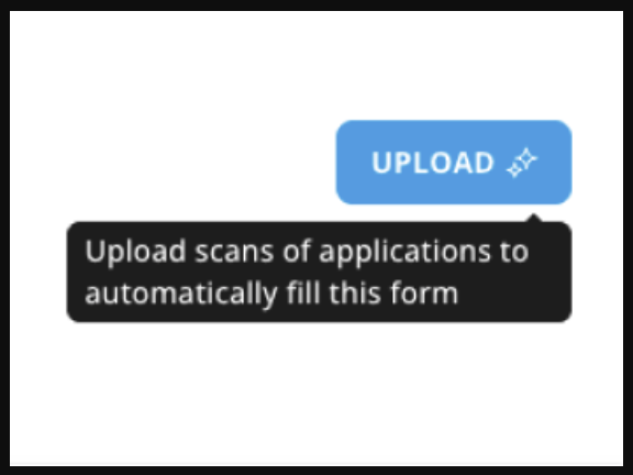
Upload PDFs to Fill Historical Permits
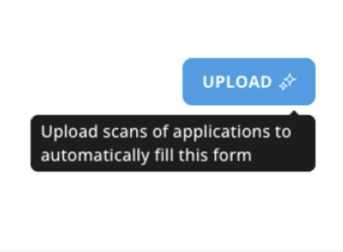
We’ve made it easier to load historical permits into Gilly.
Admins can now upload a PDF of a historical permit, and Gilly will automatically scan the
document and extract the information into the electronic form.
Just review the extracted data, make any necessary edits, and submit the form — no need to
retype everything manually.
🔍 This is the first version of the PDF upload feature, and we’re already working on improvements.
We’d love to hear your feedback, your input helps us make Gilly better.
Release Notes Version 10.0.0-10.29.2025
Version 11.0.0 10.15.2025
Inspector Role (LIMITED FEATURE)
We’re excited to introduce a new Inspector Role. This feature is designed to streamline the inspection process by giving inspectors their own dedicated tools and workflows.
From the Admin role:
Assign inspections directly to specific inspectors
See who is assigned to each inspection from the Permits Dashboard
From the Inspector role:
Create and manage their own accounts
Access a personalized dashboard listing all inspections assigned to them
Complete inspections directly from their account — online or offline
📣 We want your input!
This feature is currently in limited release, and we’d love to hear what you think.
Release Notes Version 11.0.0 - 10.15.2025
Version 8.2.0 7.31.2025

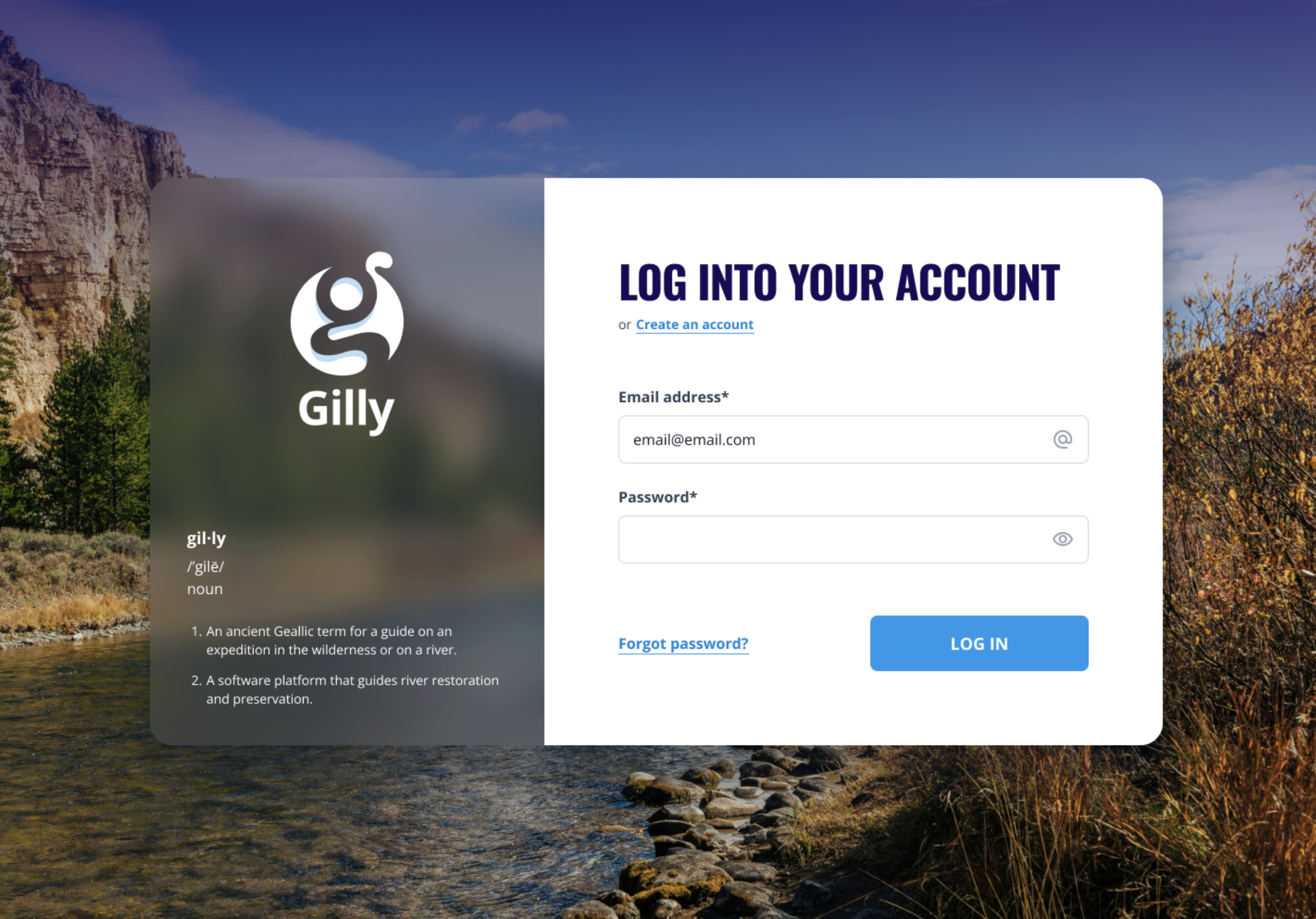
New Login & Create Account Experience
The login and create account pages have been redesigned to provide a smoother and more user-friendly experience. Improvements have been made to help you sign in or create an account more easily, with fewer steps and a cleaner interface.

Permit Application Form Optimized for Mobile
The permit application form has been optimized for mobile devices. It can now be completed more easily from your phone or tablet, ensuring a seamless experience whether you’re in the office or on the go.
Release Notes Version 8.2.0 7.31.2025
Version 8.0.0 7.28.2025
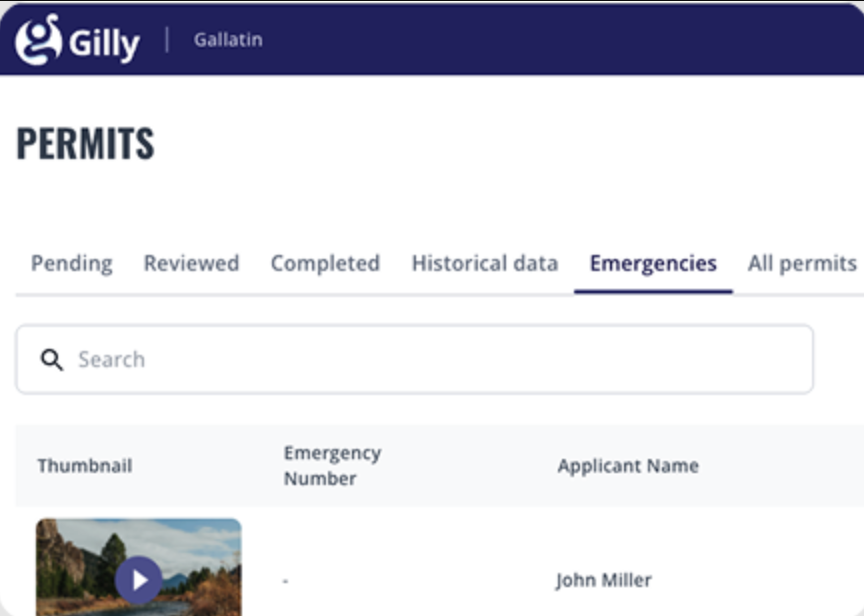
Emergency Permit Form Now Available for Applicants
A new Emergency Permit Form is now available on Gilly to help applicants comply with the 310 Law during urgent situations. This dedicated form allows individuals to report emergency actions taken to protect life, property, or crops, and submit the required information within 15 days.
Once submitted, applicants receive a confirmation, offering peace of mind that their report has been received and is being reviewed by the appropriate Conservation District.
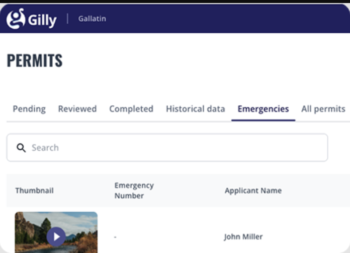
Emergency Form Management for Admins
Admin users now have access to a dedicated dashboard for managing emergency submissions. Each form includes the applicant’s justification and details of the emergency action taken.
These submissions automatically initiate a workflow that guides admins through the inspection and review process, allowing them to log inspection results and determine whether the action was appropriate, needs changes, or must be reversed.
Release Notes Version 8.0.0 7.28.2025
Version 6.0.0 - 05.21.2025
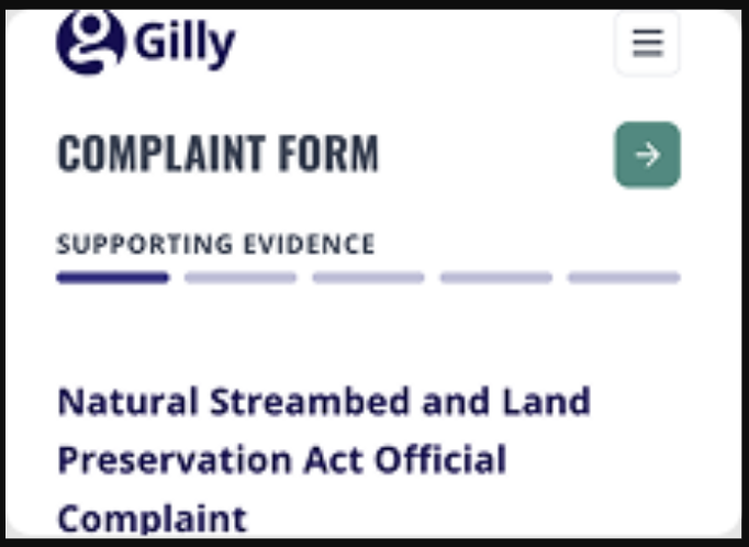
Improved Complaint Form
The Complaint Form has been redesigned to offer a smoother and more intuitive experience. It now features a step-by-step structure that guides users through the process, along with improved options for identifying the location of the activity — either from attached files or the device’s location.
The form is fully optimized for mobile use, and once the location is set, the corresponding Conservation District is automatically selected to simplify submission.
Version 5.10 03.19.2025
Updated 2025 Application Form
The Gilly application form has been updated to the 2025 version, offering a clearer and more organized experience. Personal information is now better structured for easier input, and the generated PDF is more evenly distributed for improved readability.
To make things even simpler, instructions are now provided in a separate file, and refined character limits ensure more accurate data entry throughout the form.
Release Notes Version 8.0.0 7.28.2025
Version 5.9 2.25.2025
Dashboard for Applicants
The Gilly applicant dashboard has been redesigned with a fresh new look and improved mobile-friendly features. Applicants can now easily filter, sort, and search through a table displaying all their past applications.
Additionally, the “In Progress” tab now includes every application still under review, providing a clearer overview of ongoing processes.
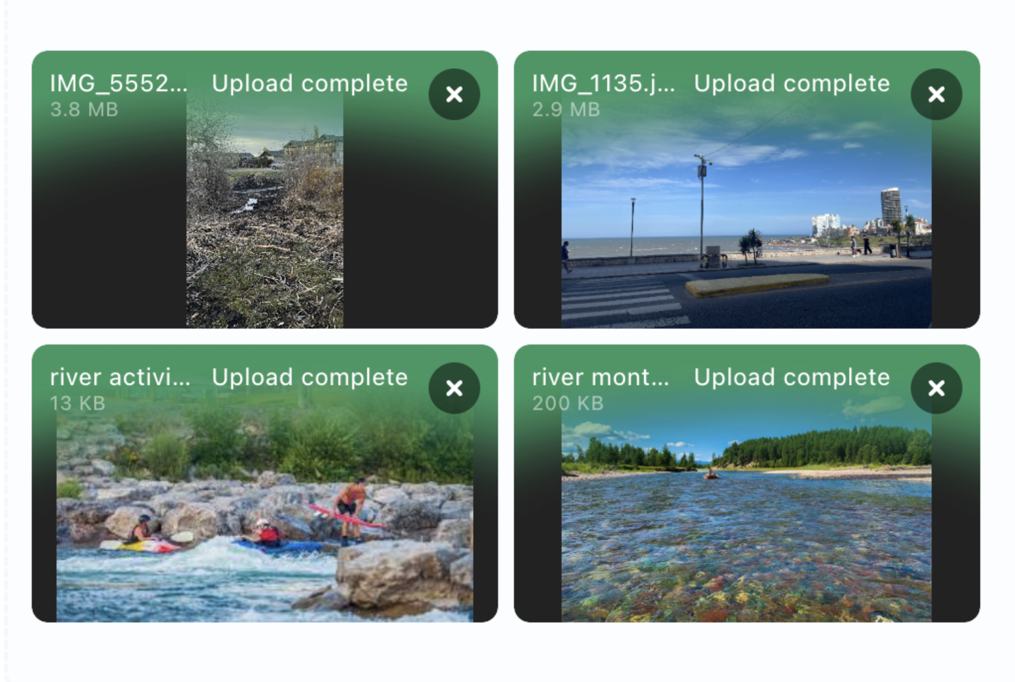
Improved Attachments View
Managing attachments just got easier. Users can now preview uploaded files directly within Gilly, making it more convenient to review documents before submitting an application.
Even better, video files can be played directly on the platform, allowing users to confirm their files are correct before submission and making the process more seamless and user-friendly.
Release Notes Version 5.9 2.25.2025
Version 5.8 11.29.2024
Agency Users
We have created a new role for agencies on the Gilly platform, designed to enhance collaboration and transparency. Agency users, such as the DNRC, can now view and download permits and inspection reports from all Conservationation Districts, as well as explore the full permits map.
This role provides agencies with streamlined access to critical information, making it easier to stay informed about the permit review process and support conservation efforts.
Release Notes Version 5.8 11.29.2024
Version 5.7 11.29.2024
Complaints Submission for Montanans
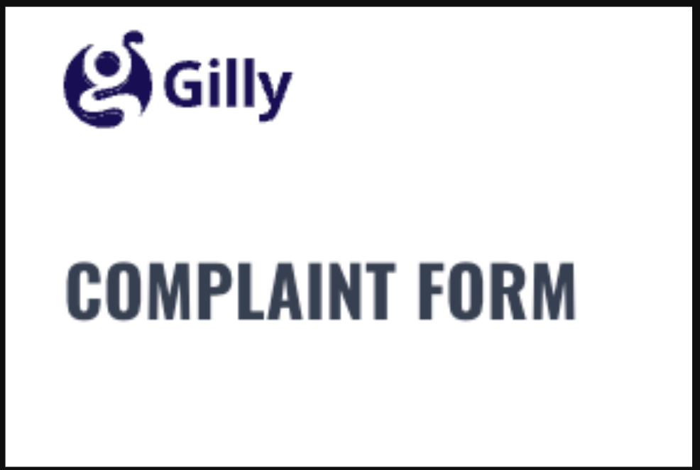
Gilly now includes a dedicated feature for Montanans to submit complaints about natural streambed and land preservation issues. This new form allows Montanans to mark complaint locations directly on the map and attach photos and videos for more detailed reports.
Once submitted, the form is automatically sent to the appropriate Conservation District for review, helping streamline the reporting process and promote environmental stewardship.
Complaint Management for Conservation Districts
Each Conservation District with an account now has a specialized complaint dashboard in Gilly to manage incoming submissions. With this new tool, districts can review submitted complaints, document inspection information, and classify each case based on its resolution needs.
Complaints can be marked as either “Action Required” or “No Action Required,” providing a clear status for efficient follow-up and management.
Enhanced User Experience
We’ve improved the look and feel of form headers, making it a better experience to submit joint permit applications through the platform.
Release Notes Version 5.7 11.29.2024
Version 5.4.6 - 10.25.2024
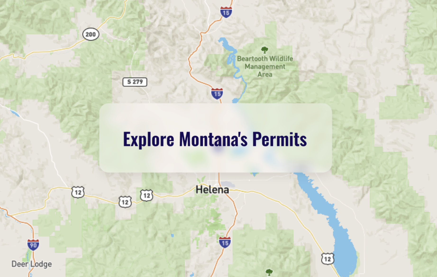
Public Permits Map
The Gilly permit map is now publicly accessible, offering detailed insights into joint applications. Users can explore permit information, including location, status, applicant details, project purpose, and submission date. With powerful filters, finding specific projects is easier than ever, and you can also toggle between map layers to contrast additional information with the permits. This update provides greater transparency and makes permit data more accessible to everyone.
Version 5.3 - 10.17.2024
New Dashboard
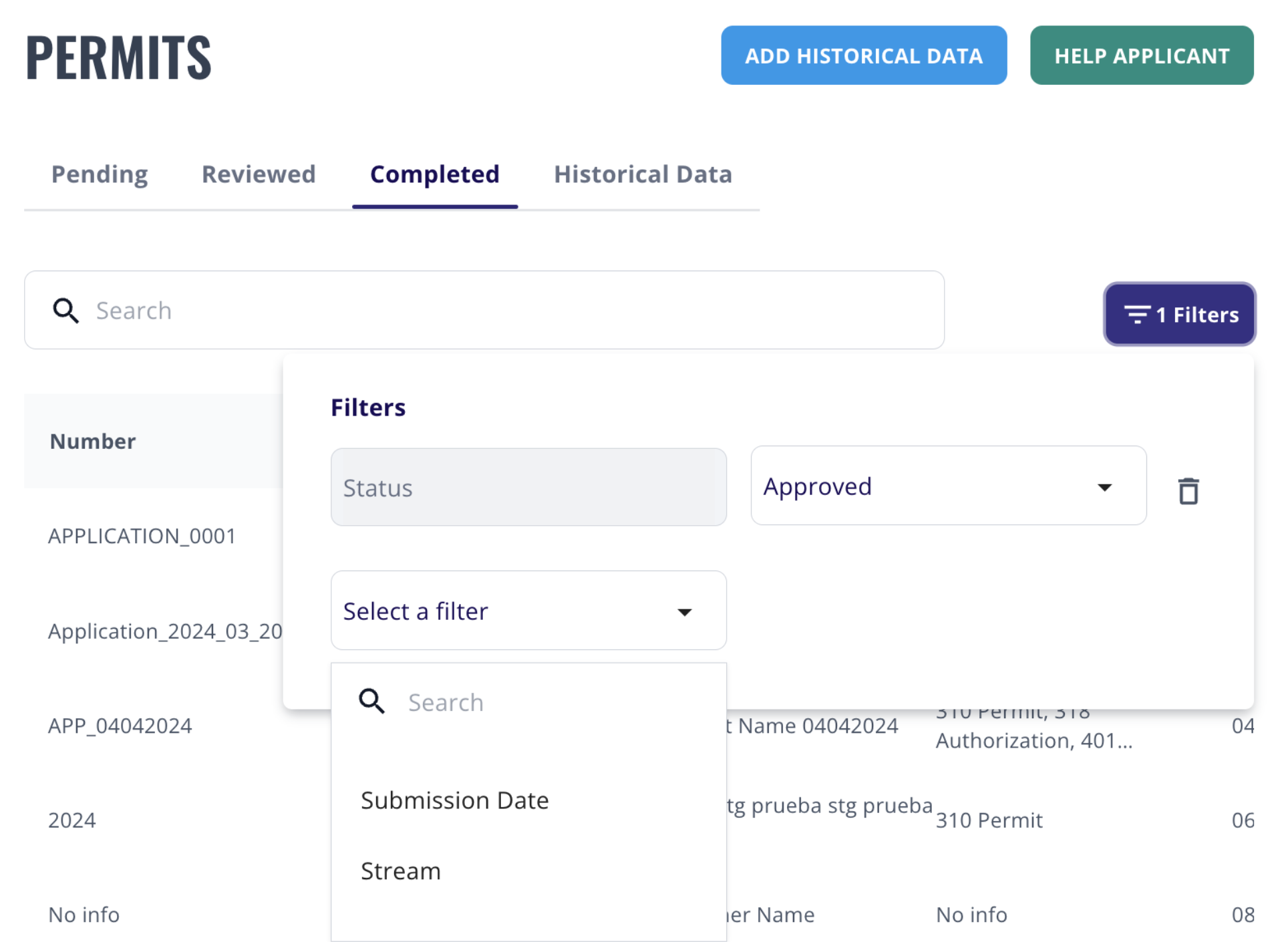
The latest update to the Gilly admin dashboard brings a modern look with enhanced clarity, making it easier to navigate and manage data. You can now sort tables effortlessly by clicking on the arrow beside any column title. Additionally, powerful filters allow you to refine the permit list by status, stream, and submission date, anad you can apply multiple filters simultaneously for precise results. Clearing filters is just as simple, with a single click on the 'X' next to the filter button.
On-Site Inspections
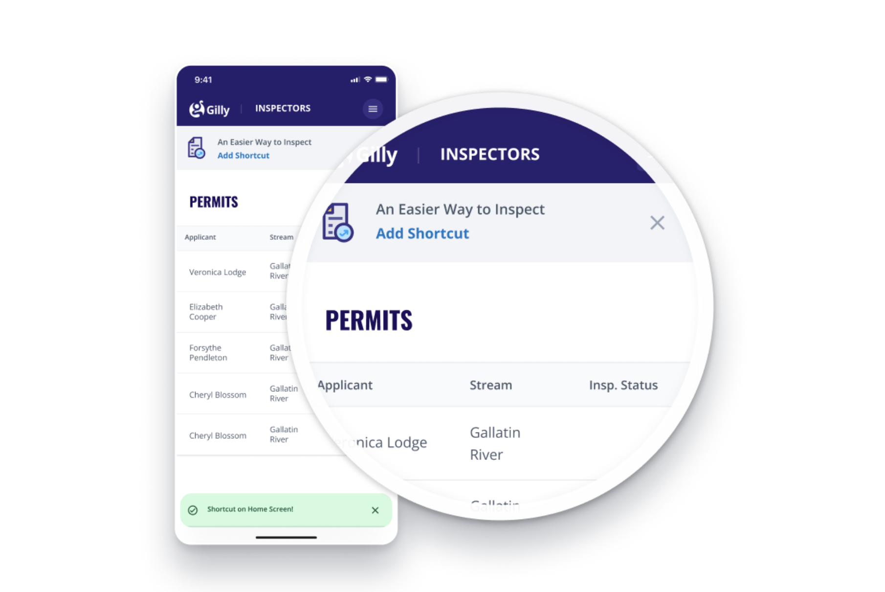
If you are a CD inspector, now you can access Gilly from your phone and take it with you to perform the on-site inspections. Don't worry about the internet signal, if you're offline and have fully completed one or more forms, once you recover the signal and refresh the app, the system will automatically sync with the web platform so everyone on your team can find the updated inspections.
Release Notes Version 5.3 - 10.17.2024
Version 5.2 - 09.04.2024
Application Form Improvements
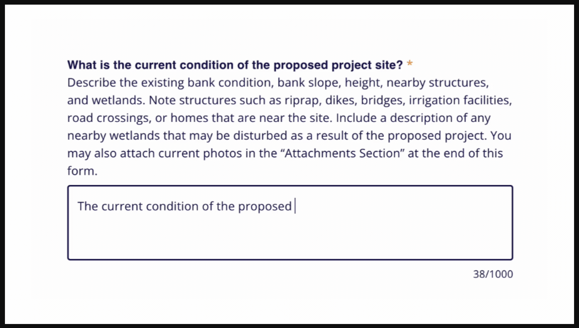
On the applicant side, project durations are now calculated automatically, streamlining the
process. Attachments are dynamically adjusted based on the permit type selected, offering a
tailored experience. If the chosen CD lacks a Gilly account, an email with a PDF form is sent. To
improve information quality, attachments exceeding 10MB are sent as separate files. Paragraph
fields now display the maximum character limit and include a live character counter, enhancing
user experience by providing real-time feedback.
Inspection Form & Historical Data
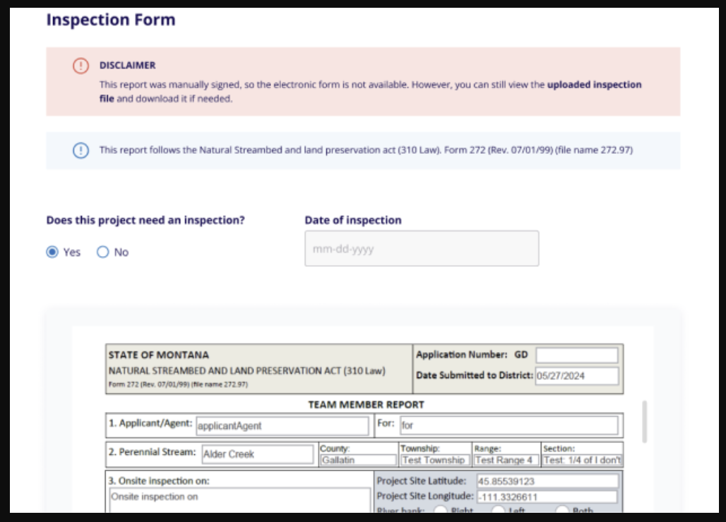
On the admin side, we've introduced important updates to enhance clarity and accuracy. When
an inspection is signed manually, CD administrators will now see a disclaimer indicating that the
electronic form may differ from the printed PDF, with a PDF preview provided to prevent any
confusion. Additionally, the Historical Data form (formerly known as the "Abbreviated form") now
includes field validations to ensure that only the correct data is entered, minimizing errors and
improving data integrity.
Version 5.0 - 07.01.2024
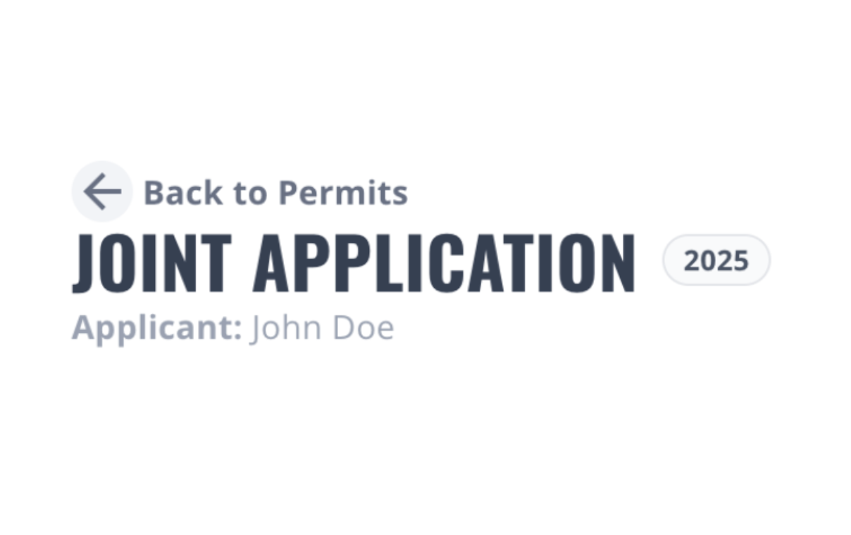
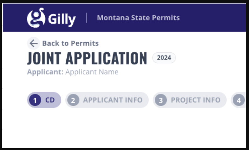
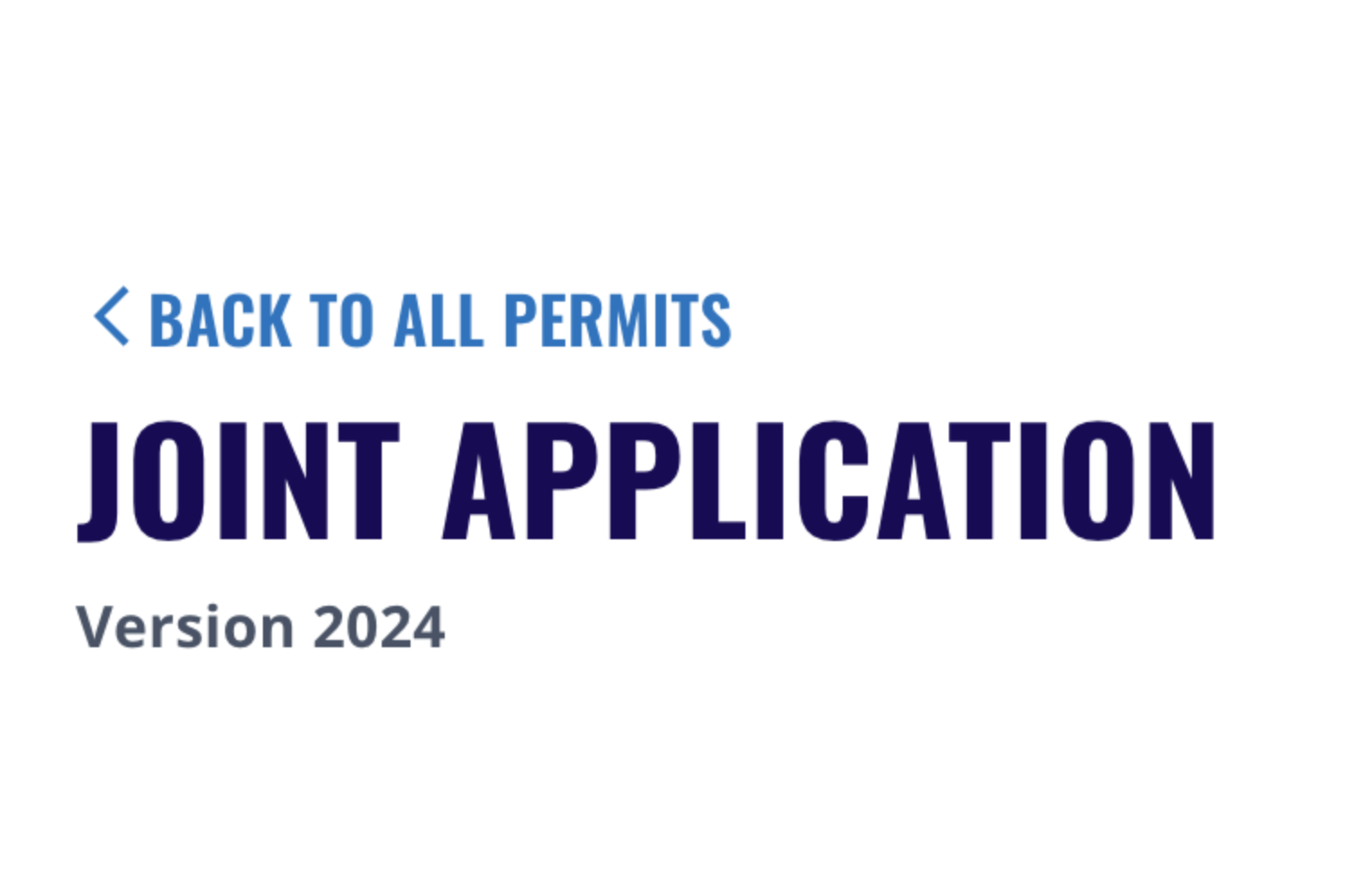
Joint Application Forms
The joint application form was updated to match the 2024 version published by the DNRC. All new application forms will now be created using this updated version. Additionally, there were changes applied to the form to improve the pdf format; and a new comments field has been added at the end of the form, allowing applicants to provide any extra information they believe is important for the conservation district to consider.
Release Notes Version 5.0 - 07.01.2024
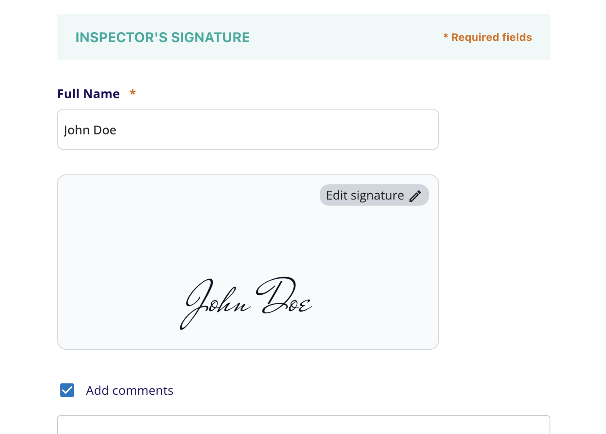
Inspection Form
The inspection form has been improved to better meet the needs of conservation districts. The new features include an option to skip the inspection if not required, integration of the project location segment with the application form's map and pre-populated details, electronic signature capabilities for both inspectors and representatives, and a comments section for inspectors to provide additional information for the conservation district's final decision.
Version 4.0 - 04.24.2024
Integrated Electronic Signatures
Now, you can conveniently sign your permits directly within our platform, saving valuable time and streamlining the entire application workflow. Simply choose your preferred signing method – typed name, drawn signature, or uploaded image – and submit your application with ease. This enhancement signifies our commitment to providing a user-friendly and efficient experience.
Saved Messages
Once you sign your first permit in Gilly, we’ll remember your choice for future applications. This added convenience saves you valuable time
Send Permits To Any Conservation District
Previously, applying for permits with CDs who aren’t set up with Gilly yet involved manual steps like emailing or physically delivering applications. Now, Gilly automatically sends permits to these CDs upon user sign-off. The review process continues via email with CD personnel.
Release Notes Version 4.0 - 04.24.2024
Version 3.4 - 04.05.2024
Location Thumbnails
Now, alongside your project details, you`ll have a visual snapshot of the exact location-—adding clarity and context to your endeavors. Explore with ease and visualize your progress like never before!
Release Notes Version 3.4 - 04.05.2024
Auto-Fill Location Details
Say goodbye to manual input! 😌
With our latest update, pinning your location on the map automatically populates essential parameters such as address, county, geocode, township, section, and range—all with just one click. Streamlining the process, you can now focus on your project with ease, saving time and eliminating the hassle of manual data entry.
Security Improvements
Enhanced security measures are now in place to safeguard your experience. Upon registration, email validation ensures a secure entry into our platform. Additionally, empowering you with password visibility and flexibility, you can now modify your password at your convenience, minimizing errors and ensuring your account remains protected.
New Look and Feel
We are excited to announce that we have refreshed the design of our platform to make it more modern and easy to use! 🎉
We have integrated visual elements that mirrors the essence of water conservation. The shapes and movements are now more fluid, creating a more enjoyable user experience.
It’s important that the platform helps raise awareness about the importance of water conservation.
Think of Gilly as your digital assistant for the permitting process — it helps applicants save time, reduce confusion, and avoid costly mistakes. Conservation Districts get fewer incomplete applications, faster reviews, and a cleaner digital trail.
-
![Cloud upload icon indicating cloud storage or uploading]()
APPLY ONLINE
Speed up the permitting process and submit documents in one secure place.
-
![Clock with a blue circular background and white outline, showing the time at approximately 12:00.]()
SAVE TIME
Save time by centralizing the permit application and reviewal process.
-
![Document with magnifying glass and checkmark]()
ORGANIZE
Keep your permit info in one place, save and print permit pdfs
-
![Icon of a gear with a checkmark inside it on a blue background]()
STAY CONNECTED
Communicate directly with your CD through Gilly